


How the Glaciers Actually Made Wisconsin Look the Way It Does
During the Ice Age, global temperatures dropped enough to allow enormous continental glaciers to form across large areas of North America.
The most recent glacial period that affected the region is known as the Wisconsinan Glaciation.
That glacial period lasted roughly 70,000 years and ended about 10,000 years ago. During that time, massive glaciers repeatedly advanced and retreated across large portions of Wisconsin.
Large sections of Wisconsin were buried beneath thick ice sheets that dramatically altered the physical features of the state. Movement of glaciers carved valleys, created lakes, deposited sediment, and reshaped hills and plains.
Wisconsin’s present-day terrain, including lakes, hills, soils, and valleys, formed largely through the advance and retreat of glaciers during the final Ice Age.
Wisconsin’s Unglaciated Region
Southwestern Wisconsin contains a region known as the Driftless Area. Name refers to the absence of glacial drift, a term used for sediments usually left behind after glaciers melt.
Most regions across the northern United States contain layers of glacial deposits that include sand, gravel, clay, and scattered boulders. Driftless Area lacks most of those deposits because large ice sheets never covered that region during the last Ice Age.
The location of that region includes parts of southwestern Wisconsin and extends into neighboring states.
View this post on Instagram
- southwestern Wisconsin
- southeastern Minnesota
- northeastern Iowa
- northwestern Illinois
Absence of glacial coverage preserved older terrain that existed long before the most recent Ice Age. Rivers and erosion shaped that terrain gradually over long geological periods without the heavy reshaping caused by glacial movement.
How the Terrain Differs
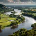
Terrain inside the Driftless Area differs sharply compared with most of Wisconsin. Steep hills, narrow valleys, and rugged bluffs dominate the region instead of smoother ground common in glaciated sections of the state.
Older river systems carved deeply into the bedrock over thousands of years. Continued erosion produced complex valley networks and steep slopes.
- steep hills formed through long-term river erosion
- narrow valleys that cut deeply into bedrock
- tall limestone and sandstone bluffs
- winding river systems such as the Wisconsin and Mississippi tributaries
Glaciated portions of Wisconsin usually display smoother terrain because glaciers flattened surfaces while depositing sediment layers. Driftless Area kept older terrain patterns since glaciers never passed across that region.
Many scientists consider that region important for studying the terrain that existed before glacial reshaping affected the surrounding areas.
The Ice Age and Glacial Movement in Wisconsin
Massive climate changes during the Ice Age allowed thick ice sheets to grow across large portions of North America. Gradual cooling produced conditions where snow accumulated faster than it melted. Over thousands of years that snow compressed into ice that spread outward across the continent.
Glacial movement reshaped terrain across large sections of the northern United States, including Wisconsin.
The Wisconsinan Glaciation
Wisconsinan Glaciation represents the final major glacial period that affected North America. Ice sheets expanded southward out of Arctic regions and covered much of the northern United States.
Geological evidence indicates glaciers advanced into Wisconsin roughly 26,000 years ago. Expansion continued until large portions of the state were buried beneath thick ice.
- glaciers advanced across Wisconsin about 30,000 years ago
- peak glacial coverage occurred roughly 20,000 years ago
- gradual warming caused ice retreat beginning about 15,000 years ago
- most ice disappeared around 10,000 years ago
Ice sheets reached extraordinary thickness during that period. The depth of glacial ice in certain areas approached nearly one mile.
The weight of that ice pressed downward on the ground surface while glaciers slowly moved across the region.
How Glaciers Shaped Wisconsin’s Terrain
Glacial activity created many of the visible physical features found across Wisconsin today. Movement of massive ice sheets altered the ground surface through both erosion and deposition.
Two processes played the most important roles in shaping the terrain during that period.
Erosion
Advancing glaciers functioned like enormous bulldozers that scraped layers of soil and rock across the ground surface. Constant movement of ice-carved depressions and valleys while smoothing hills.
Pressure exerted by thick glaciers crushed rock beneath the ice. Grinding action produced fine sediment that later became part of glacial deposits.
- broad depressions created by glacial scraping
- widened valleys produced by ice movement
- smoothed hills where rock surfaces were worn down
Long periods of glacial motion reshaped older rock formations that had existed long before the Ice Age.
Many valleys and basins across Wisconsin developed during that period of glacial erosion.
Deposition
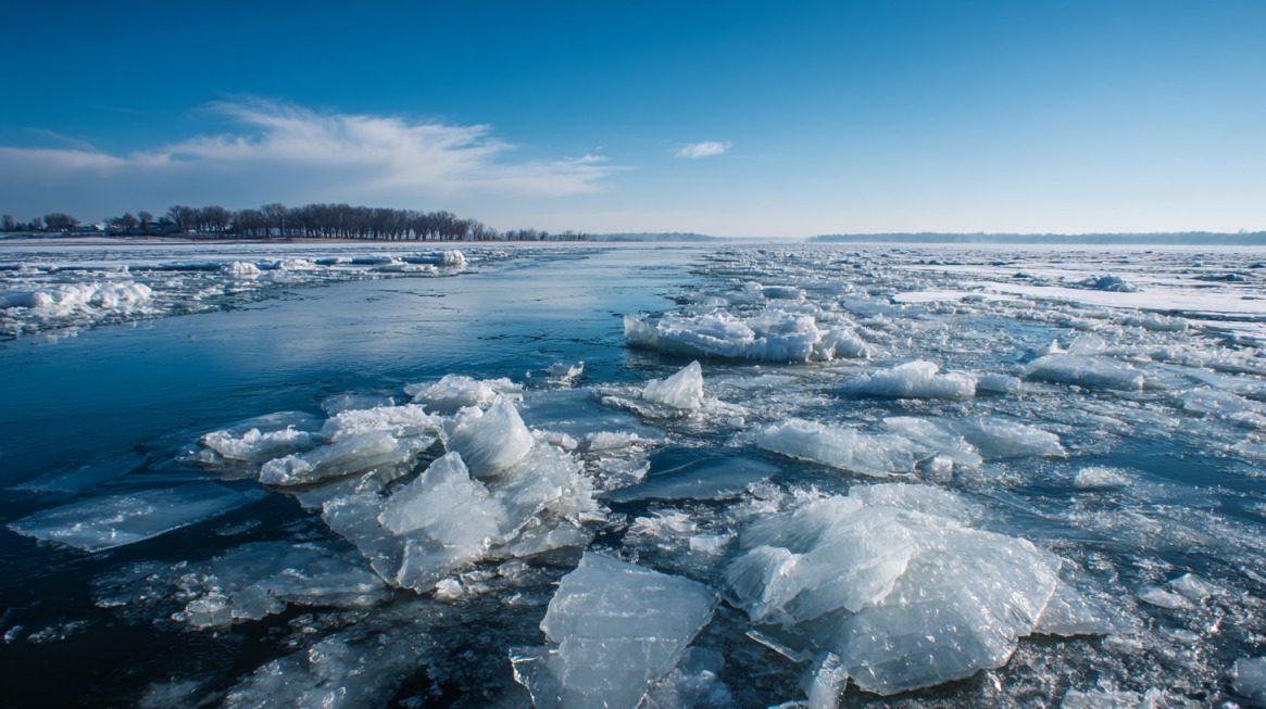
The retreat of glaciers released enormous quantities of sediment known as glacial drift. Meltwater and melting ice dropped mixtures of sand, gravel, clay, and large boulders across large portions of the state.
Deposited materials formed several recognizable landforms. Many of those formations remain clearly visible across Wisconsin today.
- moraines, which formed as ridges of debris pushed or dropped by glaciers
- kettle lakes created when buried ice blocks melted and left water-filled depressions
- eskers that formed as winding ridges of sand and gravel left by streams beneath glaciers
- kames, irregular hills made of sand and gravel deposited by meltwater
Large areas across Wisconsin contain those formations, providing clear evidence of past glacial activity.
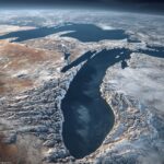
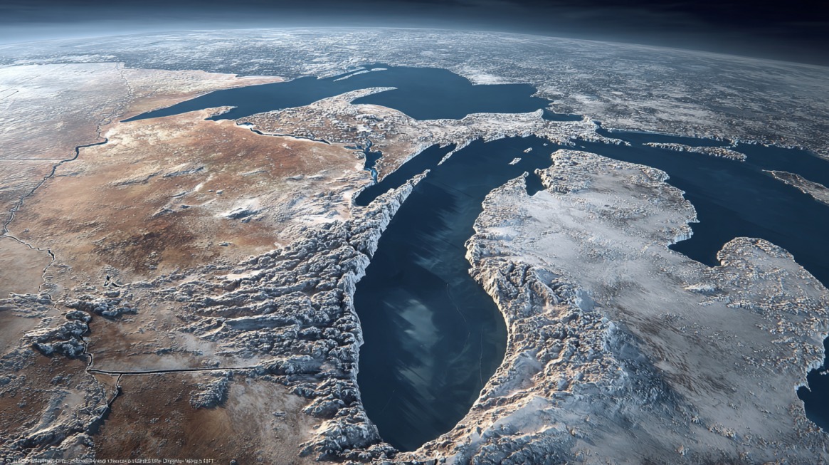
The Creation of the Great Lakes
Glacial activity did not only reshape Wisconsin. Ice sheets also transformed large portions of North America and created some of the largest freshwater bodies on Earth.
Formation of the Great Lakes resulted directly from the movement and melting of continental glaciers during the last Ice Age.
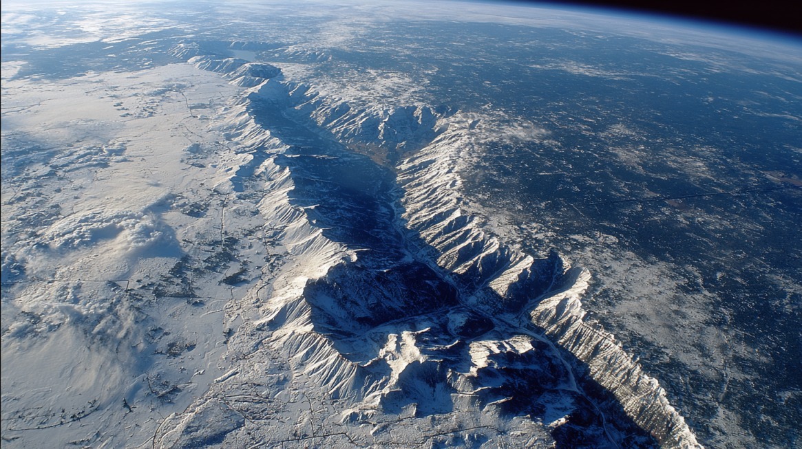
Glaciers Carved Out Massive Basins
Massive glaciers carved deep basins into bedrock as ice advanced across the region. Pressure of thick ice scraped and deepened older depressions across large sections of North America.
After glaciers melted, water filled those basins and formed the five Great Lakes.
The combined system holds an enormous volume of freshwater. Water contained in those lakes represents the largest freshwater system on Earth.
Development of the Modern Great Lakes System
Great Lakes stretch across roughly 1,000 miles of territory shared by the United States and Canada. They are full of shipwrecks and history, telling a story of how it all came to be.
Weight of glacial ice had compressed land beneath it for thousands of years. Gradual melting removed that pressure and allowed land to slowly rise again.
Process of rising ground after ice removal is called isostatic rebound. Changing elevations gradually altered water flow and drainage routes between lakes.
Early configuration of those lakes differed significantly compared with modern conditions.
- Lake Superior
- Lake Michigan
- Lake Huron
Later geological adjustments slowly separated those waters into the modern Great Lakes system.
Formation of Wisconsin’s Lakes, Rivers, and Wetlands
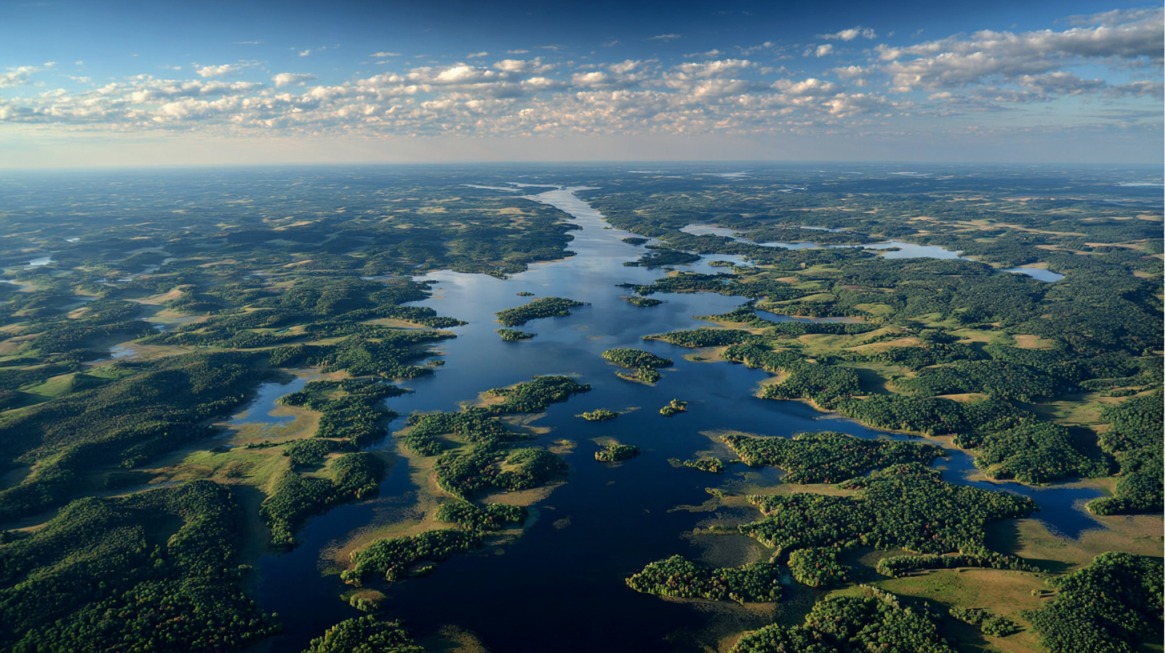
Retreat of glaciers produced enormous quantities of meltwater that shaped Wisconsin’s water systems. Rivers, lakes, and wetlands developed as glacial ice melted and water filled low areas across the region.
Meltwater activity continued altering terrain long after glaciers began retreating.
Meltwater Lakes
Retreating glaciers released large volumes of water that collected in depressions left behind by ice movement. Temporary lakes formed across many parts of Wisconsin as meltwater accumulated.
Some of those lakes eventually drained after new channels opened and allowed water to flow away.
Evidence of those earlier meltwater lakes can still be found in many parts of Wisconsin.
River Systems and Drainage
Early meltwater lakes drained through river systems that differed greatly compared with modern drainage patterns.
Land gradually began rising after glaciers melted due to the removal of heavy ice. Changing elevation slowly redirected water flow across the region.
Ancient drainage routes differed significantly during early stages of glacial retreat. One important example involves early Lake Superior, known during that time as Lake Duluth.
Gradual uplift of land later redirected water toward eastern drainage routes. Modern system now sends water through the Great Lakes and eventually into the St. Lawrence River.
Summary
Glaciers during the Wisconsinan Ice Age reshaped Wisconsin through powerful processes of erosion and deposition.
Movement of massive ice sheets carved basins, valleys, and hills across large portions of the state.
Melting glaciers created the Great Lakes, thousands of smaller lakes, wetlands, and extensive river systems. Deposited sediments produced fertile soils that later supported agriculture and settlement.
Contrast between glaciated regions and the Driftless Area reveals the dramatic influence glaciers had on Wisconsin’s geography.