


What You’ll See on a Hike Along the Ice Age Trail
The Ice Age Trail is a National Scenic Trail located entirely within Wisconsin, tracing the outer edge of the last continental glacier’s reach. Stretching roughly 1,000 to 1,200 miles, it crosses a wide range of terrain across the state.
Recognition as one of only 11 National Scenic Trails in the United States, and one of only two contained within a single state, sets it apart in the national trail system.
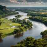
Hikers can choose short day hikes near towns or commit to extended backpacking trips. Forest paths, open prairies, rolling hills, and water features appear along different segments, offering varied experiences across Wisconsin.
Glacial activity roughly 10,000 to 12,000 years ago shaped the terrain visible along the trail today. Massive sheets of ice carved ridges, gouged valleys, and left behind distinct formations such as kettles, moraines, and eskers. Walking along the route reveals clear evidence of Wisconsin’s Ice Age geologic past. A perfect trail for kids’ field trips!
Accessibility adds to its significance. Numerous trailheads sit close to major communities, and many sections accommodate beginners while still offering challenges for experienced hikers.
Geological Features and Terrain You’ll Encounter
The Ice Age Trail presents one of the clearest displays of glacial geology in the United States. Every mile reveals evidence of ice sheets that advanced and retreated roughly 10,000 to 12,000 years ago.
Ground underfoot often follows contours shaped by immense pressure, meltwater flow, and shifting debris left behind as glaciers receded.
Ancient Glacial Landforms
Trail segments trace the edge of the last glaciation, often climbing atop ridges or dipping into hollows formed by melting ice.
Massive glaciers sculpted Wisconsin’s surface, leaving a catalog of formations that remain visible today.
- Moraines, which appear as long ridges of rock, sand, and gravel deposited at the glacier’s edge.
- Eskers are narrow and winding ridges formed by meltwater rivers that once flowed beneath thick ice.
- Kames are irregular mounds created by sediment collecting in pockets within or against the glacier.
- Drumlins are smooth and elongated hills shaped by moving ice that streamlined the earth beneath it.
- Kettle lakes, depressions formed when buried ice blocks melted and left water-filled basins behind.
Rocky stretches scattered with glacial erratics add further texture to the terrain. Erratics are large boulders transported long distances by ice and dropped as glaciers melted. Outwash plains stretch across flatter sections, created by sediment carried and sorted by rushing meltwater.
Deep troughs and uneven ground show how dramatically advancing ice altered preexisting contours.
Varied Terrain Types
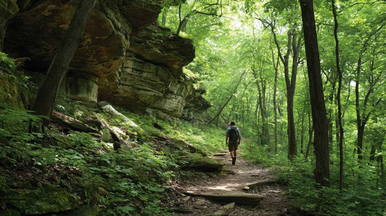
Shifts in elevation and surface conditions keep hikes engaging across different segments. Some areas demand steady footing and moderate climbing, while others offer gentler grades suitable for long-distance walking.
Devil’s Lake area presents steep quartzite bluffs and rugged ridgelines. Stone steps and exposed rock surfaces require careful movement, especially after rain. Sweeping views reward hikers who reach higher points.
Central Wisconsin transitions into rolling hills and broad plains shaped by glacial deposits. Grassy corridors and open stretches allow wide views across farmland and wooded patches. Certain sections pass directly through towns, where paved paths and sidewalks briefly replace dirt tread before the route returns to natural ground.
Water Features and Views
Water appears frequently along the trail, often in forms directly linked to glacial history.
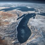
Kettle lakes and small ponds dot many segments, their rounded basins marking spots where ice once rested. Calm surfaces create quiet resting points during longer hikes.
Flowing rivers cut through rock and sediment, adding movement and sound to otherwise quiet stretches. Seasonal water levels can alter the appearance of these areas, especially during spring snowmelt.
Natural Environments and Flora
Shifts in geology support a range of plant communities across the state. Forest, prairie, and wetland environments appear in rotation as hikers move along different segments. Soil type, drainage, and past glacial activity influence which species thrive in each location.
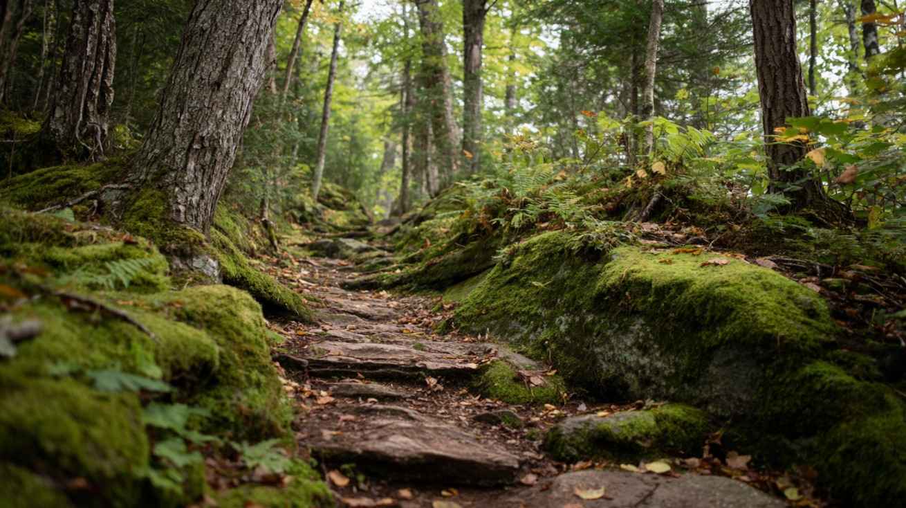
Forested Zones
Aspen, maple, oak, and pine forests line extensive portions of the trail. Oak savanna areas gradually give way to denser stands of hardwoods and evergreens. Ground cover often includes ferns, moss, and spring wildflowers.
Walla Hi and Hartman Creek segments provide clear examples of wooded hiking. Pine needles cushion the path in certain stretches, creating a soft surface underfoot. Filtered sunlight passes through layered canopies, producing shifting patterns across the trail.
- Spring introduces budding leaves and early wildflowers.
- Summer brings thick green canopy and shaded corridors.
- Fall covers the ground with red, orange, and yellow foliage.
- Winter reveals bare branches and long sightlines through the trees.
Prairie and Meadow Sections
Southern and central portions of the trail include open grasslands shaped by historical fire patterns and glacial soils. Tall grasses sway in open air, and unobstructed horizons create a sense of space distinct from forest corridors.
Summer months bring bursts of wildflowers scattered among prairie grasses. Species adapted to well-drained soils and full sun thrive in these areas. Insects and pollinators remain active during warm weather, adding movement across flowering fields.
@iceagetrailorg Hey, you there! Learn about the Ice Age Trail, find a segment near you to hike, or come volunteer! 💛🦣💙 #iceagetrail #wisconsin #hiking #nature #outdoors ♬ original sound – Ice Age Trail Alliance
Wetlands and Marshy Edges
Low-lying ground near kettle lakes and slow-moving streams supports wetlands and marshes. Moist soil conditions allow reeds, sedges, and aquatic plants to flourish. Frogs, turtles, and waterfowl often inhabit these zones.
Boardwalks appear in certain segments to protect fragile ground and maintain safe passage for hikers. Elevated planks prevent erosion and limit disturbance to sensitive vegetation growing in saturated soil.
Wildlife Sightings Along the Trail
Animal activity varies according to region, season, and time of day. Quiet movement and early morning hours increase the chance of spotting wildlife. Forest, prairie, and wetland environments each support distinct species.
- White-tailed deer moving across clearings or browsing at forest edges.
- Red fox traveling through fields in search of small prey.
- Smaller mammals such as squirrels, chipmunks, and raccoons inhabiting wooded areas.
Northern segments near Chequamegon-Nicolet National Forest extend into more remote territory, where human presence decreases and wildlife patterns remain less disturbed.
Birdlife shifts across regions. Ruffed grouse inhabit northern woods, often flushing suddenly near the trail. Bald eagles circle above rivers and lakes, scanning for fish. Southern prairie sections host meadowlarks and other songbirds that fill open air with calls during spring and summer.
Notable Segments Highlighted by Hikers
View this post on Instagram
Certain sections receive frequent praise due to scenery, terrain variety, or water features.
- Walla Hi Segment covers 2.3 miles across forested hills with rolling tread and rock steps that add texture and mild challenge.
- Hartman Creek Segment spans 5.3 miles through pine needle-covered woods, where seasonal shifts in color and nearby lakes enhance the walk.
- West Bend Segment extends 6.7 miles over rolling hills, passing forests, creeks, and lakeside views that change with elevation.
- St. Croix Falls Segment runs about 9 miles near the western trailhead, pairing St. Croix River views with mixed terrain that alternates between wooded paths and open stretches.
- Dells of Eau Claire Segment stretches 2.6 miles and presents powerful river rapids cutting through a rocky gorge, often ranked among the most striking sections.
Seasonal Variations in What You’ll See
Changing seasons transform scenery and trail conditions across the year. Temperature, foliage, and water levels shift noticeably, creating distinct hiking experiences.
Spring and summer bring bright foliage and blooming wildflowers across forest and prairie sections. Rivers flow steadily after snowmelt, and lakes shimmer under longer daylight hours.
Fall introduces bold color changes in hardwood forests. Overlooks and ridgelines display vivid tones that contrast with evergreen stands. Cooler temperatures make longer hikes more comfortable.
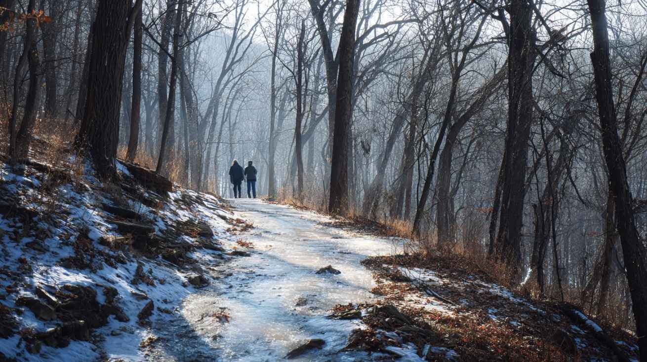
Winter covers glacial formations in snow and quiets many segments. Snowshoeing and cross-country skiing become possible in certain areas. Bare trees reveal contours of moraines and drumlins more clearly, exposing the shapes carved by ancient ice.
Closing Thoughts
A hike along Ice Age Trail moves across terrain shaped by ancient ice and sustained by present-day communities.
Rocky ridges, peaceful forests, open prairie sections, historic stops, and expansive water views come together across Wisconsin.
Time spent on the trail connects hikers with both geologic history and living towns that continue to care for this remarkable route.