


How Many Counties Are in Wisconsin? The Exact Number
Wisconsin’s administrative framework provides a fascinating look into how governance operates at a local level.
Each county serves as an essential building block for public administration, combining both rural and urban characteristics.
Knowing how many counties exist and how they function helps citizens understand the structure that supports education, transportation, law enforcement, and local decision-making.
Now, let us take a look at how many counties are in Wisconsin.
What is the Exact Number?
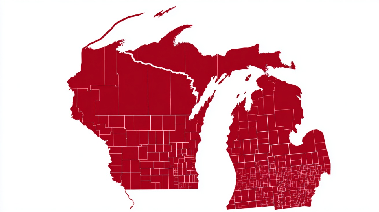
Confirmation by the State Cartographer’s Office and the WCA officially establishes that Wisconsin has 72 counties.
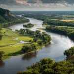
Counties in Wisconsin differ remarkably in terms of population, land area, and lifestyle. Large metropolitan centers and small rural regions both play crucial roles in shaping Wisconsin’s social and economic character.
Urban counties such as Milwaukee, Dane, and Waukesha are densely populated and host major business districts, universities, and transportation hubs.
On the other hand, there are rural counties like Pepin, Buffalo, and Rusk that have farming traditions, forested areas, and tight-knit communities where agriculture remains central to daily life.
Every county operates under a local government structure, generally overseen by an elected county board. This governing body supervises public safety, transportation infrastructure, social services, elections, and property records.
- Local road maintenance and snow removal.
- Public health and emergency services.
- Election management and record keeping.
- Parks, recreation, and community facilities.
When it comes to the counties themselves, here are all of them:.
| County | County Seat | Region |
|---|---|---|
| Adams County | Friendship | Western |
| Ashland County | Ashland | Northwest |
| Barron County | Barron | West Central |
| Bayfield County | Washburn | Northwest |
| Brown County | Green Bay | East Central |
| Buffalo County | Alma | Western |
| Burnett County | Siren | Northwest |
| Calumet County | Chilton | East Central |
| Chippewa County | Chippewa Falls | West Central |
| Clark County | Neillsville | West Central |
| Columbia County | Portage | Southern |
| Crawford County | Prairie du Chien | Southern |
| Dane County | Madison | Southern |
| Dodge County | Juneau | Southern |
| Door County | Sturgeon Bay | East Central |
| Douglas County | Superior | Northwest |
| Dunn County | Menomonie | West Central |
| Eau Claire County | Eau Claire | West Central |
| Florence County | Florence | North Central |
| Fond du Lac County | Fond du Lac | East Central |
| Forest County | Crandon | North Central |
| Grant County | Lancaster | Southern |
| Green County | Monroe | Southern |
| Green Lake County | Green Lake | Southern |
| Iowa County | Dodgeville | Southern |
| Iron County | Hurley | Northwest |
| Jackson County | Black River Falls | Western |
| Jefferson County | Jefferson | Southern |
| Juneau County | Mauston | Western |
| Kenosha County | Kenosha | Southeast |
| Kewaunee County | Kewaunee | East Central |
| La Crosse County | La Crosse | Western |
| Lafayette County | Darlington | Southern |
| Langlade County | Antigo | North Central |
| Lincoln County | Merrill | North Central |
| Manitowoc County | Manitowoc | East Central |
| Marathon County | Wausau | North Central |
| Marinette County | Marinette | North Central |
| Marquette County | Montello | Western |
| Menominee County | Keshena | North Central |
| Milwaukee County | Milwaukee | Southeast |
| Monroe County | Sparta | Western |
| Oconto County | Oconto | North Central |
| Oneida County | Rhinelander | North Central |
| Outagamie County | Appleton | East Central |
| Ozaukee County | Port Washington | Southeast |
| Pepin County | Durand | West Central |
| Pierce County | Ellsworth | West Central |
| Polk County | Balsam Lake | Northwest |
| Portage County | Stevens Point | North Central |
| Price County | Phillips | Northwest |
| Racine County | Racine | Southeast |
| Richland County | Richland Center | Southern |
| Rock County | Janesville | Southern |
| Rusk County | Ladysmith | Northwest |
| Sauk County | Baraboo | Southern |
| Sawyer County | Hayward | Northwest |
| Shawano County | Shawano | North Central |
| Sheboygan County | Sheboygan | East Central |
| St. Croix County | Hudson | West Central |
| Taylor County | Medford | Northwest |
| Trempealeau County | Whitehall | Western |
| Vernon County | Viroqua | Western |
| Vilas County | Eagle River | North Central |
| Walworth County | Elkhorn | Southeast |
| Washburn County | Shell Lake | Northwest |
| Washington County | West Bend | Southeast |
| Waukesha County | Waukesha | Southeast |
| Waupaca County | Waupaca | North Central |
| Waushara County | Wautoma | North Central |
| Winnebago County | Oshkosh | East Central |
| Wood County | Wisconsin Rapids | North Central |
Largest and Smallest Counties by Area
County size greatly impacts how local governments allocate resources, manage transportation systems, and encourage economic activity.
Marathon County ranks as Wisconsin’s largest, covering about 1,545 square miles of land.
Its economy blends agriculture, paper production, and manufacturing, while outdoor spaces attract recreation enthusiasts throughout the year.
At the smaller end, Pepin County holds the title of smallest by land area, covering roughly 232 square miles. Its compact size makes for closely connected towns and a strong sense of local cooperation.
When legal boundaries include water areas, Ozaukee County becomes the smallest, demonstrating how measurement methods influence classification.
- Large counties focus on maintaining extensive road networks, managing vast agricultural land, and balancing conservation with growth.
- Small counties concentrate on efficient public services, small-scale infrastructure, and fostering community engagement.
Wisconsin’s range of county sizes contributes to its administrative complexity, where each area finds a strategy that fits its geography and population density.
County Demographics and Population Trends
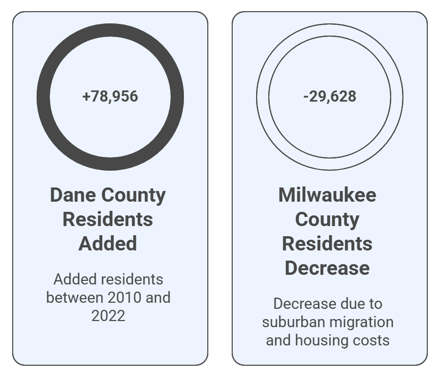
Population statistics highlight clear distinctions between Wisconsin’s counties. Dane County, home to Madison, has seen continuous growth, adding approximately 78,956 residents between 2010 and 2022.
The increase reflects expansion in the technology, education, and healthcare sectors.
In contrast, Milwaukee County experienced a decrease of 29,628 residents, largely due to suburban migration, housing costs, and shifting employment patterns.
A noticeable demographic change lies in the rising proportion of older residents. Individuals aged 65 and over form the fastest-growing group, prompting county officials to expand healthcare services and senior housing.
Rural counties, in particular, face workforce shortages as younger residents relocate to urban centers for education and professional opportunities.
- Dane County: Rapid expansion linked to economic diversification and educational opportunities.
- Milwaukee County: Population decline paired with continued cultural and industrial significance.
- Aging population: Growth in older residents driving healthcare, transportation, and community support reforms.
How Counties Are Grouped in Wisconsin
Grouping counties into regions helps state and local leaders coordinate economic, social, and environmental goals.
Wisconsin’s 72 counties are commonly divided into Southeast, Southern, Central, Western, and Northwest regions.
- Southeast Wisconsin: Home to Milwaukee, Waukesha, and Racine counties, forming an industrial and commercial hub with major highways and port access.
- Southern Wisconsin: Encompasses Dane, Rock, and Green counties, marked by educational institutions and agricultural innovation.
- Central Wisconsin: Includes Marathon, Portage, and Wood counties, where manufacturing and paper industries drive local economies.
- Western Wisconsin: Features La Crosse and Trempealeau counties, known for dairy farming, river valleys, and university towns.
- Northwest and Northern Wisconsin: Includes Vilas, Ashland, and Bayfield counties, emphasizing tourism, forestry, and recreation.
Organizing counties by region promotes cooperation on shared issues such as infrastructure development, transportation planning, education initiatives, and workforce programs.
Through these collaborations, Wisconsin continues to strengthen its counties’ collective role in the state’s progress.
Final Thoughts
Wisconsin’s 72 counties together form the backbone of the state’s organization, ensuring that local voices shape public policy, infrastructure, and community development.
Each county, regardless of size or population, contributes something meaningful, urban centers drive innovation and growth, while rural regions preserve heritage and natural beauty.
Recognizing how these local governments operate gives a better sense of how deeply community involvement influences everyday life across the state.