


7 Best Hiking Trails In Wisconsin – Top Routes, Difficulty Levels, Trail Lengths, And Best Time To Go
Wisconsin offers a wide range of hiking experiences across multiple regions of the state.
Bluff systems, caves, waterfalls, river overlooks, and Lake Superior cliffs create a strong contrast across short distances. Several trails demonstrate terrain variety, seasonal advantages, and visual rewards.
Spring brings powerful water flow, summer opens forest routes, and fall delivers expansive color across elevated viewpoints.
1. Balanced Rock Trail
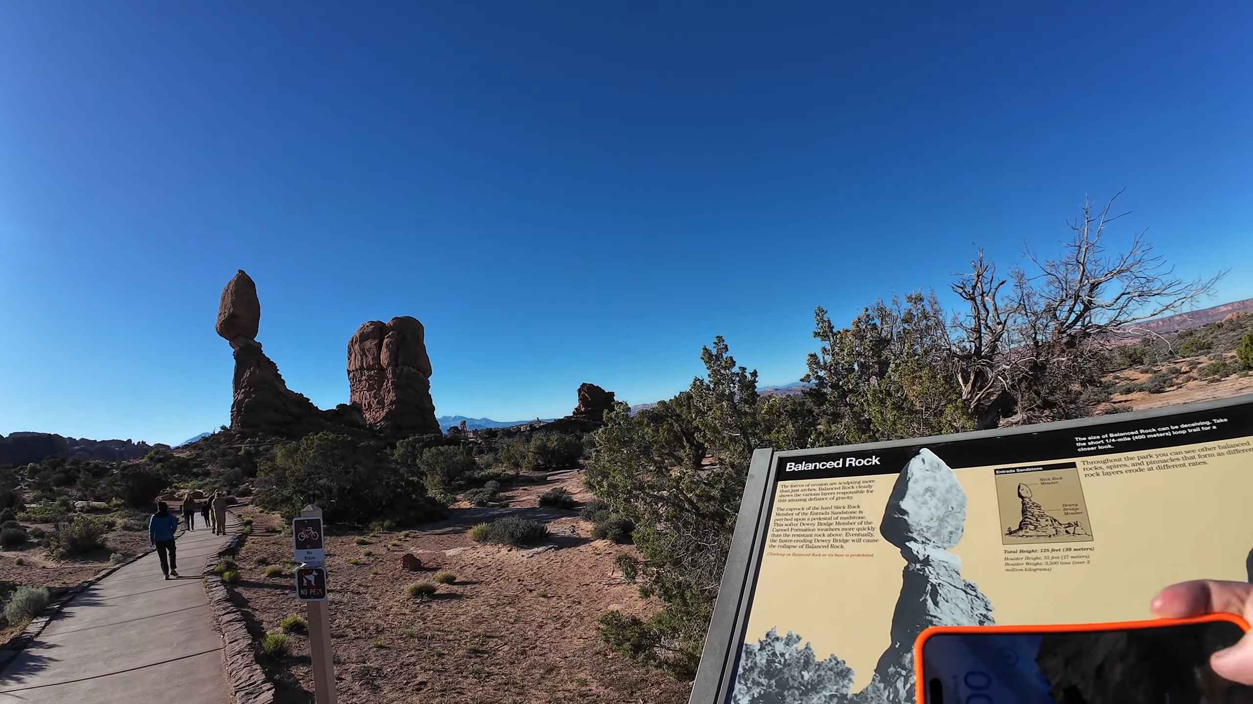
Balanced Rock Trail ranks among the most physically demanding short hikes in Wisconsin and rewards effort with rapid elevation change and constant visual payoff. Located in the
Driftless region, the route climbs aggressively along exposed quartzite formations, requiring attention with nearly every step.
- Length reaches roughly 0.9 miles one way
- Elevation gain approaches 500 feet
- Difficulty qualifies as strenuous due to the sustained incline and uneven rock
Rock stair segments alternate with narrow ledges and sharp switchbacks. Foot placement matters throughout the climb, especially during busy periods when passing becomes limited. Panoramic views across Devil’s Lake (one of the most beautiful lakes to find in Wisconsin) appear early and repeat often, creating brief recovery moments between steep sections.
Vertical cliff walls rise close to the trail, adding scale and intensity. Balanced Rock itself appears near the upper portion, marking progress and serving as a visual anchor.
Timing plays a major role in the overall experience. Early morning hours reduce congestion and allow smoother movement along tight passages. Fall conditions bring strong color contrast across surrounding bluffs while cooler air helps regulate exertion.
Trekking poles support balance for hikers managing loose gravel and angled stone.
Route flexibility increases near the summit. East Bluff and West Bluff trails connect closely by, allowing total mileage to extend into a five-mile loop without increasing technical demands. Peak season congestion remains common, so visits outside summer weekends improve rhythm and comfort across the climb.
2. Doughboy Trail
View this post on Instagram
Doughboy Trail delivers steady scenery across a compact loop in Northern Wisconsin and works well for a wide range of experience levels. Terrain remains approachable while still offering constant points of interest.
- Total distance reaches 1.8 miles
- Elevation gain stays near 200 feet
- Difficulty ranges between easy and moderate
Water drives the experience along this loop. Copper Falls, Brownstone Falls, and Tyler Forks appear at separate intervals, each framed by forested gorge walls and exposed rock.
Wooden bridges span narrow river channels, keeping views open while simplifying crossings. Sightlines remain active across most sections, preventing long stretches without visual engagement.
Seasonal timing alters mood and sound. Spring brings heavy water flow and mist near the falls. Fall introduces dense color across surrounding trees without limiting accessibility. Trail maintenance remains strong, keeping footing predictable and navigation intuitive.
Connection points link directly with the North Country Scenic Trail, allowing longer extensions without vehicle relocation.
Visual payoff stays consistent across nearly the entire loop, making distance feel shorter than measured.
3. Brady’s Bluff
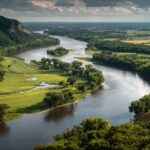
Brady’s Bluff rises above the Mississippi River and provides a steady climb toward an expansive overlook. Located in the Driftless region, the route balances effort with frequent visual breaks that help regulate pacing.
- Total distance reaches three miles round trip
- Elevation gain totals roughly 400 feet
- Difficulty stays within a moderate range
Stone staircases support footing during uphill segments, reducing erosion and stabilizing steep sections.
Forest corridors gradually thin as elevation increases, allowing river views to expand outward. A shelter marks the summit and offers space for rest, photos, and extended viewing.
Fall evenings create ideal conditions. Cooler air improves comfort, while sunset light stretches across the river valley and surrounding hills. Trail intersections near the summit allow optional mileage increases for hikers seeking additional time on foot.
Atmosphere mirrors long-distance eastern mountain trails without extended travel or complex logistics.
4. Morgan Falls and St. Peter’s Dome
@ghost_of_northland_edu Ready to fall in love with Northland’s backyard? 🍁 Take a hike with us to Morgan Falls and St. Peter’s Dome! #NorthlandCollege #FallHike #Hiking #Adventure #OutdoorLife #AshlandWi #AshlandWisconsin #Wisconsin #Northwoods #onthisday ♬ Voice of Nature – Lesfm, Olexy
Morgan Falls and St. Peter’s Dome combine water features with a high elevation viewpoint in Northern Wisconsin. Route structure creates a clear progression across distinct terrain segments, keeping effort varied and engaging.
- Parking area to Morgan Falls covers 0.9 miles with minimal gain
- Morgan Falls to St. Peter’s Dome adds 1.4 miles and roughly 450 feet of climbing
- Dome descent returns hikers over 1.9 miles
Morgan Falls qualifies as the second-tallest waterfall in Wisconsin and shows the strongest flow after rain or snowmelt. Pathways near the falls remain relatively gentle before the climb intensifies toward the dome.
Upper sections introduce rockier footing and sharper grade, demanding slower pacing near the summit.
Trail markings remain clear throughout the route. Summer and early fall provide a stable footing and open views across the forest canopy. Completing both sections adds value through contrast between shaded river corridors and elevated overlooks.
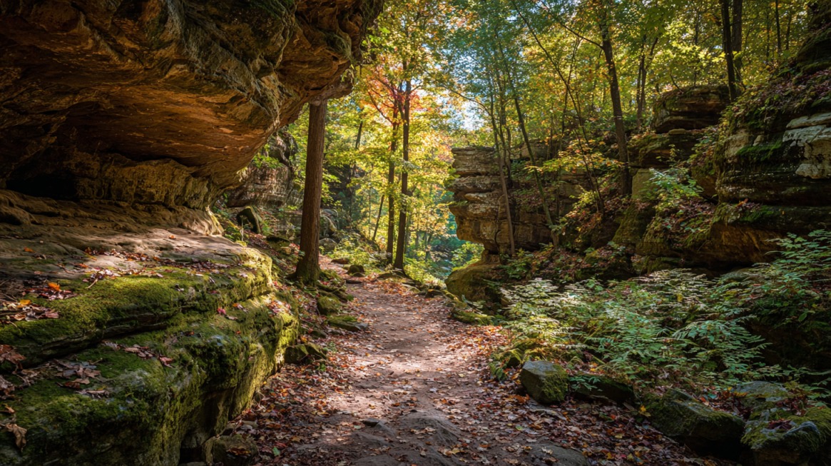
5. Pictured Rock Cave
Pictured Rock Cave follows the Sugar Maple Trail in the Driftless region and offers geological interest across a short, low-effort walk.
Route length and grade make the trail accessible without sacrificing visual detail.
- Distance stays under two miles round trip
- Difficulty rates as easy
A limestone cave anchors the experience and pairs with a small seasonal waterfall that appears during spring or after rainfall. Dense forest cover moderates temperature and keeps noise levels low, creating a calm setting even during busier seasons.
Trail traffic remains lighter compared to nearby overlooks. Moist conditions increase contrast across rock surfaces and surrounding plant life.
Short duration allows the trail to function well as a brief stop within a larger park visit.
6. Cave Overlook Trail
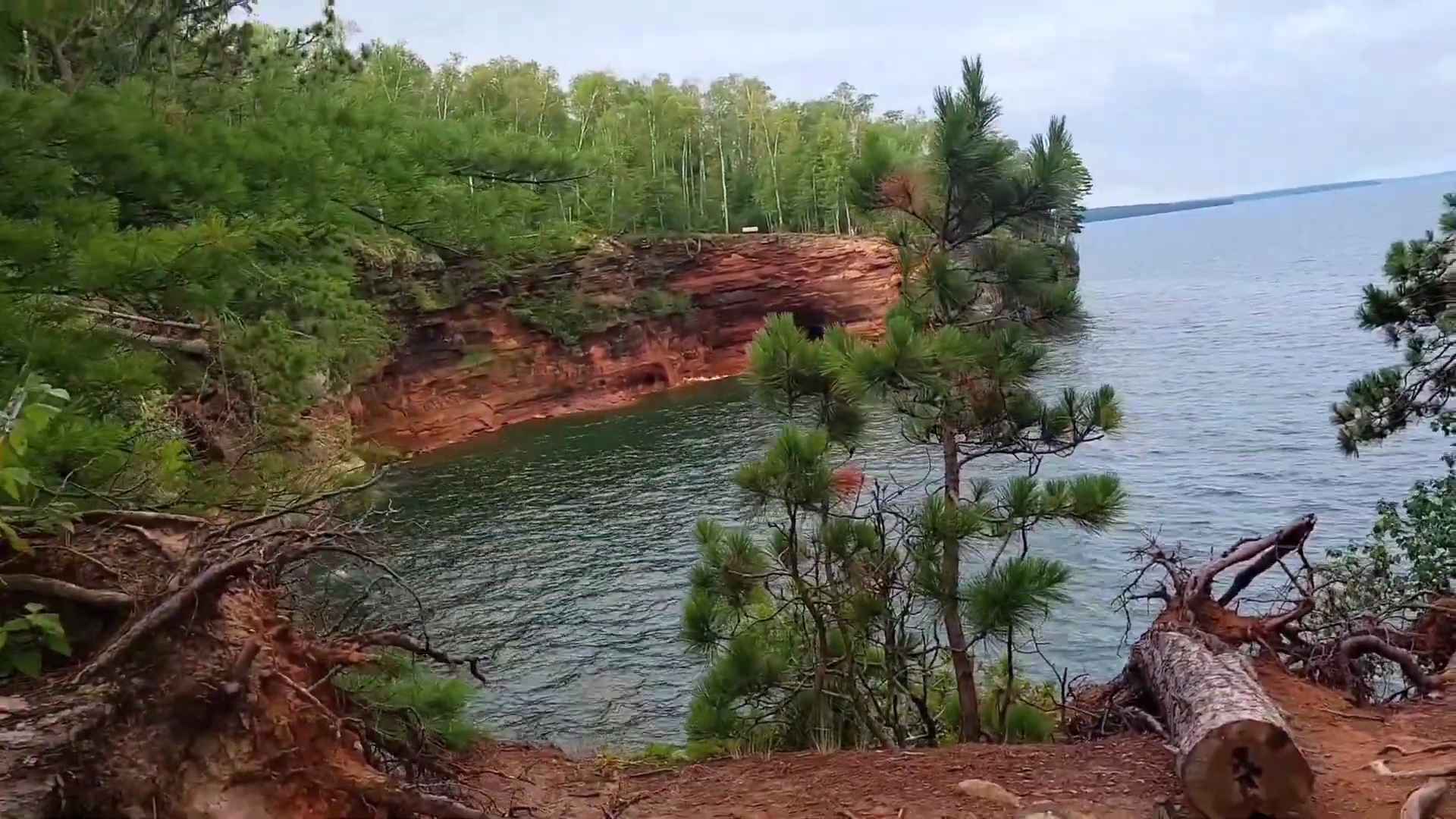
Cave Overlook Trail leads hikers toward elevated views of Lake Superior and red sandstone cliffs in Northern Wisconsin. Effort comes primarily through distance rather than steep grade.
- Total distance reaches 3.75 miles round trip
- Elevation gain totals about 200 feet
- Difficulty falls between easy and moderate
Trail quality remains average through forested sections, with limited views until approaching the endpoint. Visual payoff increases significantly near the overlook known as The Bowl, where cliffs drop sharply toward open water.
Kayaking access points sit below the viewpoint during calm lake conditions.
Summer supports combined hiking and water activity. Early fall improves comfort, visibility, and color clarity. A 5$ National Lakeshore day use fee applies unless covered by an America the Beautiful pass.
7. Blue Mound State Park Overlook Towers
@expeditionkristenWhy aren’t more people talking about this underrated state park in southern Minnesota? 🦬 🏕️ 📍Blue Mounds State Park, Luverne Minnesota It’s a beautiful park with prairies and unique rock formations. Great for hiking, picnics, seeing bison and camping! The town of Luverne is also super cute with a brewery, ice cream shops, a drive-in movie theater, and so much more! 🍻🍦 Don’t forget to save this video and share with a friend! And be sure to follow @expeditionkristen for all your travel inspo in Minnesota, and beyond!♬ Second Chances – Gregory Alan Isakov
Blue Mound State Park contains the highest point in southern Wisconsin and provides wide views across the surrounding terrain.
Two observation towers face east and west, offering different perspectives depending on time of day.
- Walking distance stays under one mile total
- Difficulty qualifies as easy
Elevation creates open sightlines suitable for photography and casual viewing. Sunrise and sunset in fall deliver the strongest lighting and color conditions, making timing more important than distance.
Cave of the Mounds sits nearby and offers an additional stop within close proximity. Rolling terrain surrounding the park creates a foothill feel uncommon across southern sections of the state.
Summary
Wisconsin hiking routes deliver wide terrain contrast across manageable distances.
Steep climbs, waterfalls, caves, river overlooks, and Lake Superior cliffs shape these seven trails into a well rounded selection.
Seasonal timing improves results, with spring favoring waterfalls and fall offering peak color and clearer views.
Proper planning, early starts, and basic preparation improve safety and enjoyment across all routes.